Contact Us

Name

Email *

Message *

Showing posts with label uttarakhand. Show all posts

Thursday, July 31, 2014

Nanda Devi Raj jaat Yatra 2014 : Uttarakhand Devbhoomi


Nanda Devi Raj Jaat Yatra is a festival that stretches for whole three weeks. It is one such Uttarakhand festival that is globally famous. Innumerable people participate in Nanda Devi Raj Jat Yatra from the Garhwal-Kumaon region, the rest of the country.

Goddess Nanda Devi is a popular deity at many places of Garhwal & Kumaon region of Uttarakhand. Nanda Devi Raj Jat is organised once in every 12 years in Chamoli after royal priests' descendents and the Kunwar royal family make elaborate preprations in the village of Nauti and in Kansuwar respectively. It is primarily a religious pilgrimage spanning for 280 kilometer. The trek takes about 20 days to be completed.

This Raj jat yatra originates from the Nauti village 20 km of Karnaprayag tehsil of Indian state of Uttarakhand. The Kunwar of village Kansua inaugurates the ceremony. The legend is this that Nanda Devi, consort of Lord Shiva left her village and went to the nanda devi parbat. Therefore when the yatra starts, heavy rain occurs as if the devi is crying. This yatra covers many villages and in between the Devi meets her sister in the Bhagwati village.

This yatra is very tough on account the landscape it goes through. In between the yatra there comes a Lake Roopkund where lies the hundreds of skeletons. It is said that once the King took some dancers to this sacred place due to which heavy snow fell and people died and the dancers got transformed into stone which can be sen in Patarnachonia. The other myth is this that king Yasodhwal's wife was pregnant and while she was giving birth to her child, her placenta flowed down to Roopkund and this in turn caused the death of the people on that place. That is why the river Nandakini lost her significance and the Nandprayag is not considered sacred as the other Panch Prayags like Devprayag, Vishnuprayag, Karanprayag and Rudraprayag.

How to reach

By Air :  
  • If you want to attend Nanda devi Raj Jat yatra in 2013, nearest airport are jolly Grant Airport Dehradun in Garhwal and Pantnagar in Kumaun region of Uttarakhand.

    By Rail : 

    The nearest railway stations are Rishikesh in Dehradun District, Haridwar, Dehradun and Kotdwar in Pauri distict in Garhwal . If you want to go from kumaun than nearest railway stations is Kathgodam near Haldwani.Other station is Tanakpur where trains comes from Bareli.
  • By Road : 

    If you want to go by bus than chamoli distict is well connected with dehradun, haridwar and Rishikesh .From Kumaun Chamoli distict is connected with Rudrapur, Ramnagar and Tanakpur. Main station of this Yatra is Karanprayag which is connected with Garhwal and Kumaun. We can also attend the yatra from Chandpur gadi, Ujwalpur, Nandkesari and Tharali.These are the night hault of this Yatra.

    Nanda Devi Raj Jaat Night Hault

    Night Hault Information of Nanda Devi Raaj Jat Yatra

    No. Night Hault Distance(km)
    1 Nauti to Eda Bandhani 10
    2 Eda Bandhani to Nauti 10
    3 Nauti to Kansuwa 7.5
    4 Kansuwa to Sem 17.3
    5 Sem to Koti 12
    6 Koti to Bhagoti 11.5
    7 Bhagoti to Kulsari 15.4
    8 Kulsari to Chepdue 10.8
    9 Chepdue to NandKesari 4.7
    10 NandKesari to Faldiya 7.9
    11 Faldiya Gaun to Mundoli 7.7
    12 Mundoli to Vaan 20.2
    13 Vaan to Geroli Patal 6.8
    14 Geroli Patal to Patar Nachoniya 6.9
    15 Patar Nachoniya to Sila Samundra 3
    16 Sila Samundra to ChandniyaGhat 12.3
    17 ChandniyaGhat to Sutol 20.9
    18 Sutol to Ghat 18
    19 Ghat to Nauti 41.6

    Day 1 to 5 Yatra Details Day 6 to 10 Yatra Details
    Day 11 to 15 Yatra Details Day 16 to 19 Yatra Details


Friday, July 11, 2014

Mountain Biking in Uttarakhand

Mountain Biking in Uttarakhand Devbhoomi


Mountain biking is all about speed, control and thrill and is one of the latest ways of exploring and discovering new vistas of the Himalayan landscape. The rugged terrain and steep slopes, though risky at times, provide great mountain biking experience in Uttarakhand. The cycle trails in this region are best traversed between October and December. In India, this sport is still in its nascent stage, surviving on some financial support from the government. Blessed with rare and diverse flora and fauna, Uttarakhand is an ideal place to develop adventure sports and eco-tourism. After paragliding, mountain biking is the second most popular adventure sport in the state. The sport attracts many national and international tourists and adventure sports enthusiasts, which in turn boosts tourism activities in the state. It is a belief that in a few years, Uttarakhand is bound to become the future hub for mountain biking in Asia.
Mountain biking and cycling can be great ways to explore the towns and villages that fringe the foothills of the Himalayas. It also gives tourists the opportunity to understand the challenges that mountains have in store for them.

Routes Defined -

In Garhwal, mountain biking can be enjoyed on the Rudraprayag – Augustmuni – Ukhimath – Chopta – Gopeshwar route, the Srinagar – Pauri – Khirsu – Pawbo – Satpuli – Lansdown – Kotdar route, and the Haridwar – Dhaulkhand – Mohand – Dehradun route. More routes are yet to be identified, explored and developed. The mountain biking routes at Kumaon are not to be left out. Tourists can enjoy the Nainital – Bhawali – Ramgarh – Mukteshwar route, the Almora – Kosi – Kathpuria – Sheetlakhet route, the Nainital – Bhawali – Sattal – Bhimtal – Naukuchiyatal route, and the Nainital – Kilbury – Kunjkharak route.

Saturday, July 5, 2014

Uttarakhand Devbhoomi - The Land Of Vedas And Ancient Science

Uttarakhand Devbhoomi is a holy land steeped in many layers of Indian history, religion, spiritual aspiration and culture. It is an old land testified by Palaeolithic stone tools, rock shelters, megaliths paintings, inhabiting by humans since prehistoric times. Archaeological remains also proved that the land was a popular place for ancient Vedic practices.

Uttarakhand is surrounded by the Himalayas, and covered by forests. The land inspired seers, holy men and many saints because of its spiritual insights and serenity where they found direct realisation of the universal soul. Those seers wrote thousands of text on the human aspiration to find the ultimate truth. This is the land where wisdom put her first step before it ventured to other parts of the world, whose soil is sanctified with great sages and seers of all time. Innumerable temples and religious fervour testified the authenticity of this land, and through its people.

Since time immemorial Uttarakhand has been beckoning countless people from all over the world for its religious and spiritual opportunities in various pilgrimage routes whether it is in Badrinath or Gangotri glacier, the true source of holy river Ganges. Uttarakhand has proved time to time that religion is not just confined to temples and synagogue, and you can approach it through various ways whether you want to explore it in wilderness or rediscover yourself through trekking expeditions in the Himalayas. The life blood of this land is indeed continuing within its spiritual ambition.
Religious History of Uttarakhand

Aside for prehistoric evidence of Uttarakhand, there is very little knowledge of history of Uttarakahnd. Early scriptures described certain tribes inhabited the Garhwal and Kumaon regions, among them the prominent were Akas, Kolmunds, Nagas, paharis, Hephthalites (Hunas), Kiratas, Gujjars and Aryans. Paharis were the dominant tribe in the reigions until Rajputs and Brahmins overruled them around 13th century.

Present day Uttarakhand was also served as retreats for Rishis (seers) and Sadhus. According to Hindu mythology Sage Vyasa scripted Mahabharata (the longest epic in the world) here. The first major dynasty was Kuninda in the 2nd century B.C who practiced an early form of Shaivism. According to the relics of Ashokan dynasty it is evident that Buddhism made inroads in this region, and also Hindu cult worships like shamamism practiced here for a long time. Nevertheless, due to heavy influence of Shankaracharyaadvaitya philosophy and other Brahmanical methods, Uttarakhand remained a dominant place for orthodox Hindu worshipping.
Seat of Ancient Holistic Science Yoga And Ayurveda

Thousands of years ago sages and seers found the holistic practice of physical and mental well-being of humans through Ayurveda and Yoga. It is quite an astounding fact that even after thousands of years before the birth of Christ those therapies are revisited in the world in the form of ethics of healthy living and mental calmness. The whole world is adapting gradually the natural version of life in the name of Yoga and Ayurveda, and these age old sisters of ancient science are creating ripples in the world of modern medicines.

Both Ayurveda and Yoga have shared a philosophical commonness and therapeutic ways of cure and purgation methods as well. The similar attitudes of these sciences have a common goal – balance of body and mind. The basic Ayurvedic fundamental of healthy life is being followed in various parts of Uttarakhand since ages. Every year thousands of travellers and spiritual aspirants come to visit the place for learning Yoga and other ancient exercises. Yoga and Ayurveda are complementary to each other. The approach of healthy living can only possible fully if the system works in two legs – Yoga and Ayurveda.

Friday, April 11, 2014

Information about Hemkunt Sahib Yatra, Pilgrimage Gurdwara in India (Uttarakhand Devbhoomi)


Sikh shrine present in Uttarakhand state in India at a place called Lokpal, which is now associated with the tenth Guru, Guru Gobind Singh.

However, what distinguishes it from other historical sites linked to the great Guru is that this site is connected to the Guru’s previous incarnation as the mighty warrior, Dusht Daman. According to some interpretations, the tenth Sikh Guru mentions this place in his composition Bachitar Natak which is found in the Dasam Granth, the second most important scripture of the Sikhs. But it was not until the twentieth century after many long years of searching that Hemkunt Sahib was finally discovered or (re-discovered).

In the Indian epic and Puranic literature, Himalayan landscapes are described as the dwelling places of gods and goddesses. Pilgrimage shrines mark the places where the landforms themselves – mountains, rivers, forests, and lakes – are said to have acquired sacred qualities. High above the tree line, in the midst of a natural rock garden of moss, ferns, and flowers, is one such sacred place: a small, blue-green lake fed by water which cascades down from the surrounding mountain walls.
Background

Located in the Uttarkhand Himalayas bordering Tibet and Nepal, it is accessible only between June and October when the sun and monsoon rains melt the ice and snow that are its namesake. Then, the steep stone footpath that leads to the lake is crowded with pilgrims and tourists. They journey to the base of the route on foot from neighbouring mountain valleys, or from the plains in buses, cars, and trucks, on scooters and bicycles, even by foot. Then for two days they climb upward. Some walk, some ride mules, and some are carried by porters.

Finally, at the top of more than a thousand stone steps, the holy lake, The Sri Hemkunt Sahib Gurdwara, and the Sri Lakshman Mandir come into view. High in the snow capped mountains of the Himalayas this site has been hidden from sight for eons. For thousands of years this place has remained unknown to humans, a place of utter beauty and peaceful serenity. Here a natural lake lies on a plateau at a height of 15,000 feet surrounded by seven snow clad peaks. To the Sikhs this place is known a Hemkunt Sahib.

Before this site was discovered by the Sikhs it was known locally as Lokpal, which translates to ‘protector of the world’. Long a place of worship and pilgrimage by the local Hindu population, a place linked to the hindu trinity of the creator – Brahma, the sustainer – Vishnu and the destroyer – Shiva. The Vedas and Purana texts of ancient India mention the Himalayas as the abode of the gods and goddesses, the locals tell a modified version of the Ramayana which actually is cast in far off Lanka (Sri Lanka). tales of Lakshman, Vishu and Hanuman.

In the historic version Lakshman the brother of Rama is mortally wounded in battle while he is leading Hanuman’s army of Monkeys against some demons sent by Raavana the villianous Demon Ruler of Lanka who has stolenSita the wife of Rama. To save the fallen hero the Hindu God Hanuman jumps all the way from Lanka (Sri Lanka) to the Himalayas to get a rare plant that will save Lakhsmans life.

In the local version Lakhsman, was brought to the shores of this lake by his wife. Here she prayed to Hanuman the (Vanara) or monkey god to save Lakhsman’s life. Hanuman heard her prayers and found the life giving herb called Sanjivani Bhutti, this was given to Lakshman and he was revived. The gods were overjoyed and went to Lord Bramha to give thanks, seek his blessing and protection from the demons who ravaged the world. In their version the myth of Hanuman and Lakhsman has been blended with Sikhi to include Guru Nanak and Guru Gobind Singh, whereby Lord Brahma told them that only Nanak the ‘saviour of the universe’ can assist them in his tenth incarnation, in which, the tales relate, he will destroy evil and tyranny and will become the protector of the holy people.


Sikhs believe that this holy place, known as Hemkunt (lake of ice/lit. cut in the snow), is the tap asthan (place of meditation and prayer) at which the tenth and final living Guru of the Sikhs achieved union with God in his previous incarnation. From there, the Guru was summoned by God to be reborn into the world to teach the people the true path. The temple built on the shore of the lake commemorates his mission. It also shelters the Guru Granth Sahib, the eternal scriptural Guru for the Sikh community. The community is itself recognized as a collective Guru, and pilgrims, as they walk the path toward Hemkunt, share the sacred journey with its members.

In this way, all three forms of the Guru – the source of spiritual guidance – are understood to be present at Hemkunt. Sikh pilgrims go there to be inspired to walk the same difficult path that the Guru walked, both in body and in spirit, and to, through the Guru’s grace, realize their connection with God in the same place where the Guru realized his. At Hemkunt Sahib, Sikhs feel closer to the Guru and, through the Guru, closer to God. Gurudwara Hemkunt in the Himalayas is also regarded as one of the holiest places of the Sikhs. It was there that Sri Guru Gobind Singh the tenth and last Guru of the Sikhs is reported to have meditated in his previous life.

Saturday, April 5, 2014

Munsiyari Hill station Uttarakhand tourism


Munsiyari, the hill s stationin the Pithoragarh section of the hill-state of Uttarakhand can be found at the platform of the excellent Himalayan hill range. As exclusive as its name, this position has progressed itself as the newest preferred hill place in the condition. Located at an level of about 7,200 ft, Munsiyari is a trekker’s residence since a lot of the excellent Himalayan 
climbing shoes off from this little residence of hills and natural jungles. The name indicates a ‘place with snow’ and when winter months season is kilometers away from the rest of the nation, this position accumulates up smooth layers of snowfall over its natural sheath but the impact only comes out more positive.
The whiteness around the Goriganga river bank are sensible reason to spend a person's winter weather holidays, however, for the sport hunters this position is a energetic identify during summer time season time.And for those who never mind the periodic disturbance, Munsiyari is a position to be in any part of the year. Never be amazed when you identify different types of people viewing this little town-from meditation spirits, mountaineers, glacier fanatics, trekkers, characteristics fans to exhausted town folk-this position has respond to all the needs. For the characteristics fans, the location is home of leopard, panther, hill endure, musk deer and other creatures and wildlife.
Munsiyari is a new development as a vacationer position in Uttarakhand , until lately Munsiyari was a limited position in Himalayan inner range wedged in between region of Indian , Chinese suppliers & Nepal, restrctions have reduced now, It has placed Munsiyari on vacationer map.


Visiting Munsiyari is completely a different experiance , In rises reduced gets to woodlands are abalze with rhododendrons jungles, Hill outrageous birds like singing yeast infection, wag end,hawk,cuckoo, falcon,serpent eagle are discovered here, Wildlife like Leopard,Panther,Mountain endure,Musk deer are discovered here in Munsiyari Woods.

One can see Panchuli Mountains look like as five fireplaces, Stream Goriganga moves by Munsiyari and pipes at 18 kms lengthy Milam Glacier and combines with Balati Snow and Panchuli snowfields, Subject of Gori has several going tracks and known as trekkers heaven, Some hikes are very well-known like trekk to Milam, Namik Trekk,Ralan Glacier trekk etc. Though allows are necessary for Innerline hikes.                                        

Jeep Safaries are way to arrive at Madkote (22 Kms) , Baneanani and Jauljibi ( 66 kms), onway you can see amazing perspective of mountain surroundings and drops, Birthi Comes (31 Kms), Balati Town is a well-known travel where you will see wonderful opinions of cold Himalayas and Maheshwari kund is a peaceful pond ornamented by wetlands overflowing with lifestyle. Tubing can be done at Gori Ganga , In winter seasons Downhill runs of Khaliatop and Betuldhar offer skking options.

How to Reach Munsiyari

Munsiyari is located at a distance of 650 Kms from Delhi and 260 kms from Kathgodam Railway station, one can avail taxies from Delhi & Kathgodam for Munsiyari, One small hill airstrip is located at Naini Saini in Pithoragarh ( 130 Kms from Munsiyari), One can have a night stay at Nainital (310 Kms) , Distance from Nainital to Munsiyari is 290 kms , and roads are decent and one can full their diesel / Petrol tanks at Almora / Bageshwar.

Wednesday, March 19, 2014

UTTARAKHAND DEVBHOOMI - Narsingh Dev Temple, Joshimath, Uttarakhand


Narsingh Dev Temple, Joshimath, Uttarakhand.Narsingh is one of the avatars of lord Vishnu. When the Badrinath Temple is closed in winter, devotees throng to worship at the Narsingh Temple at Joshimath. The characteristic feature of the deity is that its left wrist is verythin and is getting thinner by the day.A legend goes about the deity's wrist is that of being a sign that the day the wrist separates from the forearm, the route to Badrinath would get closed permanently by a major land slide.

Wednesday, March 12, 2014

Kedarnath trekking tracks to be laid out new before Char Dham Yatra'14 in Uttarakhand

The Chief Minister of Uttarakhand state Mr. Harish Rawat recently announced some good news for all locals and pilgrims planning to visit the Kedarnath shrine soon. Two important trekking tracks leading up to the famous Kedarnath temple dedicated to Lord Shiva were completely damaged in the mammoth floods that affected the state during June 2013. Therefore, the State Government has recently announced that plans have started to reconstruct two tracks – one running from Rambara to Gaurikund for a length of 10km and other running from Rambara to Kedarnath for a length of 8km. For now, the Government has decided to renovate these tracks by the second week of May, right in time for the Char Dham Yatra in 2014, when thousands of pilgrims are expected to trek all the way up to the Kedarnath temple using these routes.

A final plan detailing the length and measurements of these tracks has been planned for after having fruitful discussions with the experts at NDRF (National Disaster Response Force) and GSI (Geological Survey of India). On 10th March 2014, the CM confirmed to the media that reconstruction of these tracks will startanytime soon once the weather brightens up in the state. He also stated that since these two tracks were very important for the region’s economy, they are being worked upon with great focus given to intricate details. Char Dham Yatra will be resuming by second week of June and the CM confirmed that the renovationwork is being planned in such a way to get over before this Yatra. A senior IAS officer from Uttarakhand confirmed that the roads are being constructed after careful discussions with experts from the disastermanagement committee of the state and that once there is a slight improvement in climate, work will start in full swing to target a tentative completion deadline of May second week.

Tuesday, March 11, 2014

TEMPLES IN UTTARAKHAND - SURKANDA DEVI TEMPLE

Surkanda Devi temple is one of the famous and highly worshipped places of Uttarakhand state.The temple is situated in the Tehri Garhwal district of Uttarakhand and is at a height of 10,000 feet. Surkanda devi temple is dedicated to Parvati devi who was the wife of Lord Shiva. The legends say that the Parvati became Sati (burnt alive) after an argument with her father.When Lord Shiva came to know about this, he lost his temper and did Tandav and flew with the ashes of his wife.During his journey with ashes the head part of the devi fell at this place which gave the name as – Shree Khanda which stands for head which gradually became Surkanda.


[ View of the new temple ]

The temple is located on a hill and one has to trek for around 1.5 kilometers from the base – Kaddukhal. For the people who cannot trek, there are horses and ponies available at low costs around 200 rupees.


There is a huge belief of blessings and people visit this place for taking blessings and “mannats”. Once a year there is a fair organized at the temple on the occasion of Ganga Dusshera and high number of followers visit the temple during this period.


[One gets a view of lofty peaks and greenery alongside the road]

The place is located about 30 kilometres from the hill station Mussoorie and around 60 kilometres from Dehradun- the capital city of Uttarakhand. The roads are in very good condition and temple is easily accessible. A large part of Tourists visiting Mussoorie and Dhanaulti visit Surkanda Mata Temple and during the summer seasons the rush increases comparatively to the other part of the year.


[Way to Surkanda Devi]

During winters there is moderate snowfall in the region which makes the trip highly enjoyable and fills it with fun.

Once the person reaches the top he is welcomed by the cool breeze which hits on the forehead and gives a very fresh and heavenly feeling. There is a eye soothing, heart occupying view of 360 degrees from the top of the hill which brings the camera in use.

The old temple has been renovated in past few years and will be brought to the existence during Ganga Dusshera 2013. There are small tea and snacks shops available on the top of the hill and having a maggie and tea with biscuits when the mild wind is blowing things is a very rich experience.

During the trip one can stop at Dhanaulti and enjoy a peaceful time in presence of loads of Pine trees.

There are budget hotels available in the area to stay for overnight .

Tuesday, February 25, 2014

Uttarakhand Devbhoomi- Uttarakhand CM launches develop schemes in minority community areas

Uttarakhand Chief Mnister Harish Rawat today launched 52 schemes of Rs 463.16 Lakh under the minority development fund in minority concentration areas in the state.

According to an official statement, the schemes being generated in the minority concentration areas under Vikaskhand, Vikasnagar and Sahaspur, includes development schemes for Waqf properties, graveyards, hand-pumps, Idgah, solar and street lights and anaganwadi centres.

Speaking on the occassion, Rawat said his government is working toward integrated development of all areas. He also directed concerned authorities to ensure timely implementation of these policies so that people can benefit from it.

The Chief Minister said, developmental schemes should be created timely, only then people are able to derive benefit from it. He also directed officials for quick disposal of problematic issues faced by people.

Content Copied Form  http://zeenews.india.com/

Tuesday, February 18, 2014

Uttarakhand-Panch Prayag in Uttarakhand

Devprayag


Deoprayag is regarded as the most complete showcase of legends, heritage & traditions. 70 km from Rishikesh , here the Bhagirathi from Gaumukh & the Alaknanda from Satopanth unite and for most Indians, this confluence is no less holy than the Sangam at Allahabad. These three rivers flowing majestically through sculptured channels carved through the rocks have carved angular blocks of land around the confluence & the town is set into these three angles. Located at a height of only 618 m, Deoprayag is an invocation to the gods who have gfenerously endowed this spot with tremendous natural beauty. It is believed that Lord Rama and his father King Dashratha did penance here. The temple of Raghunathji houses a tall image of Lord Rama made of black granite. The most celebrated event at Deoprayag is the congregation of devotees, who come here to worship at Raghunath temple. There is also a small temple popular as Bharat Mandir of Rishikesh in recluse. It is said that on fearing attack by Aurangzeb the pujaris from Rishikesh installed the same idol at Deoprayag as makeshift arrangement & later took it back to Rishikesh.
Srinagar the ancient capital of Tehri Garhwal is at a distance of 35 km from here.

Rudraprayag

Named after Lord Shiva (Rudra), Rudraprayag is situated at the holy confluence of Alaknanda & Mandakini rivers, at a distance of 34 km from Srinagar. It is believed that to master the mysteries of music, the sage Narad worshipped Lord Shiva, who appeared in his Rudra incarnation to bless the sage. It was here, also, that Shivas wife, Sati, was reborn after her self immolation because her father humiliated her husband. In her new life, as the daughter of Himalaya, she did penance here to ask the boon of Shiva as a husband once again. The ancient temple of Rudranathji is dedicated to Lord Shiva.
Rudraprayag is the point where the two roads branch off to the holy Shrines of Kedarnath (84 km) & Badrinath (159 km).
The entire region is blessed with immense natural beauty, places of religions importance, lakes 8c glaciers.

Karna Prayag

Situated 11 km from Gauchar, the icy flow from the Pindari Glacier becomes the Pindari river, and when it meets the Alaknanda at 788 m, the confluence is known as Karnaprayag. The wooded thickets of the hills surrounding Karnaprayag were the meeting ground for Shakuntala C Raja Dushyanta, immortalised in Kalidasa’s immortal classic and a favourite ballad ever since. The place derives its name from Kama, the son of the Queen Kunti and her fiery lover, Lord Surya (sun), Kama’s lineage was kept a secret, but he propitiated the Sun God here, and acquired a pair of earrings & armour that made him invincible. Ultimately, he fell in the battle between the Pandavas & Kauravas, but remains a tragic hero for in life he never had the legitimacy he desired. Besides the temple dedicated to Kama, the temple dedicated to Goddess Umadevi, Narayan & Gopal stand at the confluence.
69 km from Gwaldam, Karnaprayag is on the main Rishikesh Badrinath highway. From here, the road to SriKedarnath (115 km) goes through Rudraprayag & the road to Sri Badrinath (128 km) through Joshimath.
Karnaprayag is the base for treks to Roopkund and the Bedni Bugyals and the approach to the Pindari Glacier.

Nandprayag

22 km from Kama Prayag, Nand Prayag at 914 m forms the confluence of the Alaknanda & Mandakini (flowing from a glacier near Nanda Devi Peak) rivers. On their way to Tapovan across Kunwari Pass or on their way to Roopkund, it is popular with trekkers. It is said that the confluence is named for the pious Raja Nanda. According to one legend, the king had been promised the boon of Vishnu as a son. Unfortunately, the same boon had been granted to Devki, the imprisoned sister of the tyrant king, Kansa. Ultimately, the gods found an ingenuous if wily solution: Vishnu would be born as Krishna to Devki but would be brought up by Raja Nandas wife, Yasodha.

Vishnuprayag

Hormed by the confluence of the impetuous Vishnu Ganga (known after this point, as the Alaknanda) and the Dhauliganga river, Vishnu Prayag, 1372m, has an ancient temple called Vishnu Kund. It is said that the sage Narad worshipped Vishnu at this sanctified spot. Visitors will find the Kagbhusandi Lake bewitching with its emerald green depths giving it a still surface, while on the banks, blossoms evoke the colours of nature in all her glory. The lake can also be approached from Vishnuprayag beside from Bhundhar village near Ghangaria.


Monday, February 3, 2014

The Heaven - Uttarakhand Devbhoomi

Uttarakhand, is a state in the northern part of India. It is often referred to as the Land of Gods (Hindi: देव भूमि, Dēv bhūmi ) due to the many holy Hindu temples and cities found throughout the state, some of which are among Hinduism's most spiritual and auspicious places of pilgrimage and worship. Known for its natural beauty and wealth of the Himalayas, the Bhabhar and the Terai, the state was carved out of the Himalayan and adjoining north-western districts of Uttar Pradesh on 9 November 2000, becoming the 27th state of the Republic of India. It borders the Tibet Autonomous Region on the north, Nepal on the east and the Indian states of Uttar Pradesh to the south and Himachal Pradesh to the north west.
The region is traditionally referred to as Uttarakhand in Hindu scriptures and old literature, a term which derives from Sanskrit uttara (उत्तर) meaning north, and khaṇḍ (खण्ड्) meaning country or part of a country. It has an area of 20,682 sq mi (53,566 km²).
In January 2007, the name of the state was officially changed from Uttaranchal, its interim name, to Uttarakhand. The provisional capital of Uttarakhand is Dehradun, which is also a rail-head and the largest city in the region. The small hamlet of Gairsain has been mooted as the future capital owing to its geographic centrality but controversies and lack of resources have led Dehradun to remain provisional capital. The High Court of the state is in Nainital.


Recent developments in the region include initiatives by the state government to capitalise on handloom and handicrafts, the burgeoning tourist trade as well as tax incentives to lure high-tech industry to the state. The state also has big-dam projects, controversial and often criticised in India, such as the very large Tehri dam on the Bhagirathi-Bhilangana rivers, conceived in 1953, the phase one of which has already been completed. Uttarakhand is also well known as the birthplace of the Chipko environmental movement, and other social movements including the mass agitation in the 1990s that led to its formation. ..

Tuesday, January 28, 2014

Tehri Dam in Uttarakhand

Tehri Dam is a major hydroelectric project centered near Tehri Town in Uttarakhand, a state of India. It is the primary dam of the Tehri Development Project. It is located on the Bhagirathi River, the principal tributary of the holy River Ganges. The Tehri Dam has a height of 855 feet (261 m), making it the fifth tallest dam in the world. The dam's intended capabilities include a power generation capacity of 2400 MW, provision of irrigation to an area of 270,000 hectares, irrigation stabilization to an area of 600,000 hectares, and a supply of 270 million gallons of drinking water per day to the industrialized areas of Delhi, Uttar Pradesh, and Uttarakhand. Its reservoir will completely submerge Tehri Town and 40 villages, and partially submerge 72 villages.


Thursday, January 23, 2014

SOME OF THE BEST TREKKING DESTINATIONS IN UTTARAKHAND!

Trekking is referred to a journey on foot whereby there are no means of transport available.Trekking leads to exploring such places which are generally in interiors and have a very less footfall of human beings.Such places, hence, are very natural, due to less human interference and gives a peace of mind to trekkers.

Uttarakhand and Trekking

Uttarakhand has been well known for its natural tourist spots.It is a state which has been blessed by nature and there are plenty of Himalayan treks available for trekking. The treks vary from soft to hard and offer a variety to the experienced trekkers. Whether it be the meadows of Deoria Taal or the majestic views of Chandrashila, every trek has something unique to offer the visitors.


Bedni Bugyal – Aali Bugyal, Garhwal Uttarakhand:

When it comes to one of the most alpine meadows in Uttarakhand, Bedni Bugyal runs away with the show.The place is located in the Chamoli district of Uttarakhand at a height of 3350 metres above sea level.The trek consists of lush green grass meadows, coniferous forests and steep climb ways.


How to reach Bedni Bugyal and Ali Bugyal:


One needs to start from the Lohajang Pass which has a connectivity of motorable road.The trek passes from village for about 11 kms and ends at Wan village.The first 7 to 8 kilometers is a descending path while the latter part is an ascending one.

Best Season : May to November


Deoria Tal – Chopta – Chandershila, Garhwal Uttarakhand:

Deoria Tal is a treasure of nature gifted to Uttarakhand with a non comparative beauty.The place is located at a height of 3200 metres and has a tendency to captivate anyone with its mesmerizing beauty level.The story behind the place is referred where the Pandavas were asked questions by the Yaksha before having water.The lake has a surrounding of soothing fields and is set magnificently in the lap of peaks.

Chopta is one of those unspoiled places in Himalayan range which is less known to people and hence is passed by many of them. The place appears to be one from Swiss map due to the heavenly beauty and is often reffered to as Mini Switzerland also. It is an alpine meadow at a height of 2500 meters and is a protected sanctuary.The flora consists of pines, rhododendrons, oaks and deodars at their full flourish. There is an ancient track towards the Tungnath temple which gives an unparalleled view of the Himalayan peaks

The winters convert everything with a white blanket of snow and the summer Green meadows of Chopta convert into white during winters.

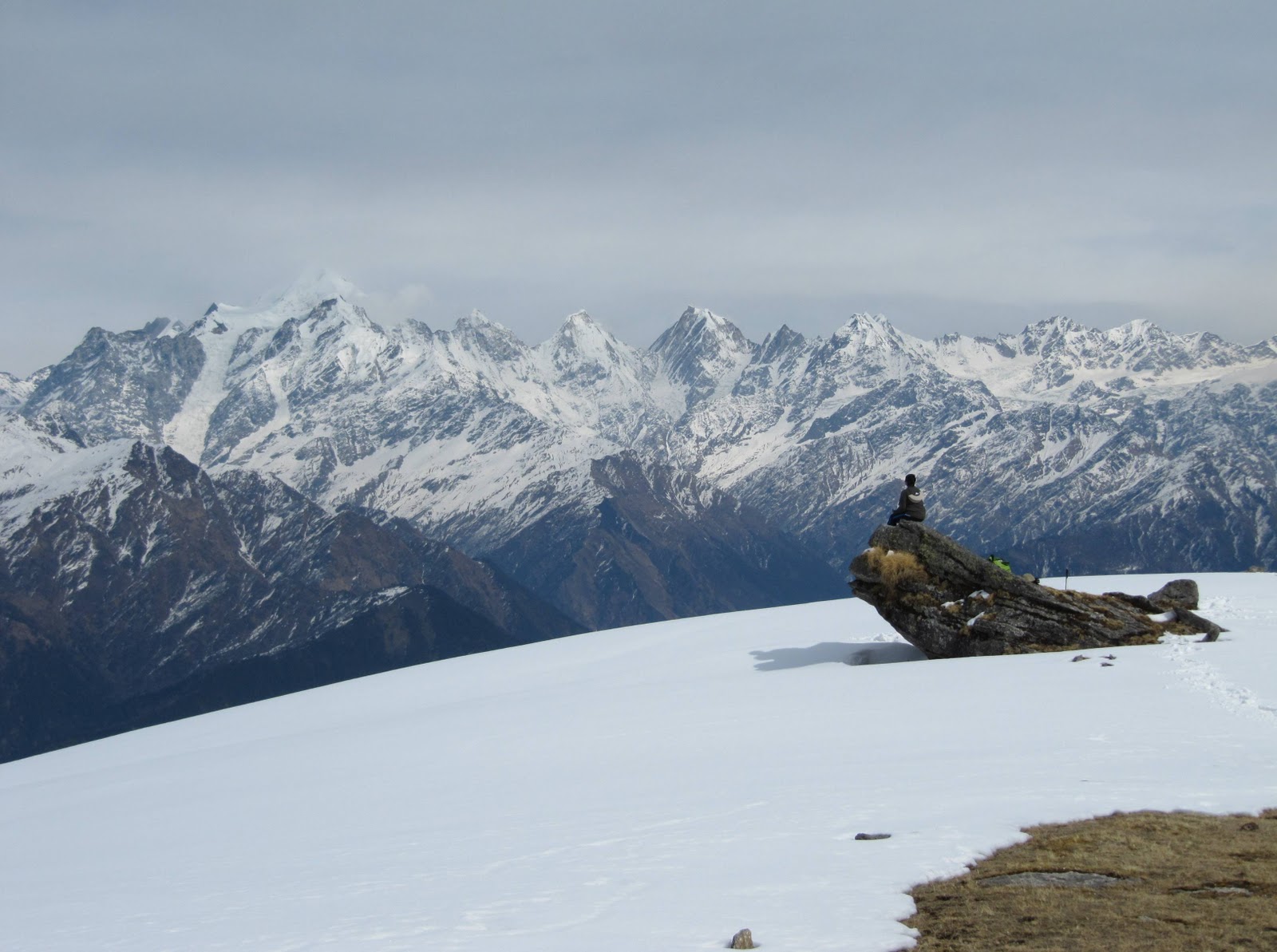
Chandrashila peak offers a majestic view of 360 degree of snow clad Himalayas. All major peaks including Nanda Devi, Chaukhamba and Trishul can be seen in on a clear day from Chandrashila.

Chopta – Chandrashila is one of the favorite Indian trekking destinations.


How to reach Deoria Tal:

Chopta is reachable through Ukhimath as well as Gopeshwar.Chopta is the starting point for trekking to Tungnath and further to Chandrashila.The best time to visit Chopta is from June to November.


Rating: Easy to Moderate
Best Season: Round the year

Gangotri (3048m) – Gaumukh (3892m), Garhwal Uttarakhand:

Alright, now we come to a trek which is very famous and well known amongst the tourist/trekkers.There are enormous delights most of which are unexpected. With every moving step, the scenery which is already so magnificent unfolds itself.

The stream viewed Kedar Ganga meets the Bhagirathi at Gangotri surrounded by the brilliant snow peaks, Brahma, The Gangea Mandir, Shankracharya and the mighty Shivling, which is called as Dev Ghat, the starting nudge to Dev Ganga.

Gaumukh is 19km north east of Gangotri. Gaumukh can be seen at the foot of Shivling (a striking un-scaled pinnacle of rock & ice). Forbiddingly beautiful, the awesome Shivling Peak looms, 6,540m above the source of Ganga at the Gangotri Glacier evokes a mystical atmosphere descending from beyond.

Gaumukh is the source to Indias most sacred river – Ganges whereby it flows from Gangotri glacier, which is a giant 30 kms long glacier.It is surrounded by mighty peaks of Shivling, Meru and the three Bhagirathi peaks while Chaukhamba being the highest peak .

The Chaukhamba cluster of snow peaks, while the three Bhagirathi peaks tower the Gaumukh springs as if these mountains were the embodiments of Shiva.


How to reach Gangotri:

Gangotri is well connected by motorable roads to most of the destinations in Uttarakhand.The nearest airport is Jolly Grant which is 250 Km from here.The nearest railway station is in Rishikesh which is situated nearly 234 Km from here.This remaining part of the journey is completed by road.


Rating : Moderate with weather unpredictable
Season: Feb to November

Har Ki Doon (3566m), Garhwal Uttarakhand:

Har ki Doon is located in the west part of Garhwal at an altitude of 3566 meters between dense forests and peaks.There is enormous flora and fauna on the way to the trek and is a paradise for bird watching and wild life lovers.

The name behind the place has a holy history whereby Hari meaning God and Dun meaning valley.Duryodhan is identified as God in this part of the world and has a temple on his name and it is believed that Pandavas went to Swarg through this mountain.The,valley has rare Brahamkamal, Bhojpatra trees, some best variety of Pine and Deodar trees.The trek is an attraction to all age groups and is a must visit for photography lovers.

Har ki Doon is the base point for Swargarohini which is situated at a height of 6400 meters and has BandarPoonch mountain on its western range.Most of the houses on the way can be observed having carvings of Mahabharata.The place is gaining an important place in terms of tourism and the foot fall is increasing

The route consists of Drive from Dehradun to Mussoorie to Sankri, Kampty falls and the Yamuna River, you will be visiting remote historical and cultural place of Jounsar-Bawar, Rawal, Jounpur and to the legendry & mythological temples of Lakhmandal (the exile of Pandavas) to Taluka Village, to Osla and then to Har-ki-Doon the trek is through terraced mountain fields, lush green grassy land and the coniferous forest and ultimately reached the wonderful multi-colored flower-ridden meadows of Har-ki-Doon.


How to reach Har Ki Doon:

Buses are easily available from Dehradun to Purola.Buses and taxis can be hired from Purola till Sankri and further till Taluka from where the actual trekking begins.

Rating :Easy
Best Season :March – June & Sept – Mid Nov

Pindari / Kafni Glaciers (3800m and upwards), Kumaon Uttarakhand:

Pindari is located at a height of 3820m in Bageshwar district. The Pindari glacier is well connected to the southwestern slope of the Nanda Devi Sanctuary.The major peaks which lie near this glacier are Nandakot (6880m),Pawalidwar (6663m), Nandakhat (6611m), and changuch (6322m) and Baljuri (5922m). It is one of the most accessible glaciers in the Kumaon region.The glacier has a total length of 3 Km and is approximately 0.25 km broad.

The Kafni glacier is the source to the Kafni River, which is a tributary of the Pindar River. The Pinder River in turn is a tributary to theAlaknanda River, which eventually leads to the Ganges.The region is known for its rich wildlife.


How to reach Pindari Glacier and Kafni Glacier:

The trek starts from Song which is a small village in Almora.The first phase of the trek leads to Dhakuri which is around 14 Km from Song.The next 25 Km or so lead to Phurkia via Dwali from where Pindari is 14 Km away.The Kafni Glacier is 12 Km from Dwali.

Rating : Moderate
Best Season: April to November.

Milam Glacier (3438m and upward), Kumaon Uttarakhand:

Milam Glacier is 27 km long and it is considered the biggest glacier in the Kumaon region.Milam village, lying very close to this glacier, is one of the highest villages found in the Himalayan range which is located on the old trade route to Tibet. Munsiyari,apart from being the starting point for Milam Glacier, is the base point for some other glaciers also among which Namik, Lilam, Poting, and Ralam Glaciers are common. The main peaks found in this region include Kalabulanddhura (6215m)Burphudhura (6215m) and Hardeol (7151m).


How to reach Milam Glacier:

One can drive from Kathgodam till Munsiyari via Almora and Bageshwar.The trek route from Munsiyari till Lilam is mostly downhill after which the route passes through some and downs with an increasing altitude till Rilkot passing through mule bridges and frozen ice streams.The next phase of the trek route upto Milam is a steep climb.

Rating: Moderate
Best Season: May-June and September-October.

Valley of Flowers (3962m), Garhwal Uttarakhand:

The valley of Flowers spreads over an area of 85.80 sq km and it is known for its large collection of wild flowers species. A large variety of flowers grow in this region including some ferns & Himalayan herbs. It is home to over 300 species of wild flowers. The valley is associated to the Ramayana and it is said that Hanuman Ji came here to collect Sanjeevani booti herb to revive Lakshman. The Pushpawati river adds to the beauty of the peak with the towering Rataban Peak in the background . The valley offers a once in a lifetime experience to those who are fond of nature. The Valley of Flowers was found by Frank S. Smythe who was a mountaineer, explorer and a botanist.He camped here for several weeks in the monsoon of 1937 and carried out his exploratory work. He then authored a book known as “The Valley of Flowers” which brought out to the world the beauty which it contained.


How to reach the Valley:

The motorable road begins at Haridwar and connects the valley upto Govind Ghat.The trek route commences from Govind Ghat and the first 13 Km lead to Ghangharia passing through zig zag mule track,terraced fields and vegetation.There are two routes from Ghangaria-one leading to the Sikh shrine Hemkunt Sahib and the other one to the Valley of flowers.

Rating: Moderate
Best Season: June-October is the best season to view this panoramic beauty .For the remaning part of the year the valley is snow covered and difficult to visit.

Roop Kund (4450m), Garhwal Uttarakhand:

Roopkund is a mysterious lake at the altitude of 4450m in the interior of Chamoli district of Uttarakhand. The lake is shallow having a depth of about 2 meters the edge of which is covered with snow for most part of the year. When this snow melts,skeletal remains of humans are visible some of which have flesh attached. Some believe that these remains are of the 300 people who died some 600 years ago. Others believe that they are the General Zorawar’s Soldiers who died in an attempt to conquer Tibet.


How to reach Roop Kund:

The trek route to Roop Kund starts from Lohajung which is located at an altitude of 2530 meters.The route leads to Bedni Bugyal via Didilana and is moderate.The next phase of the trek is comparatively easy and follows upto Patar Nachauni.The route from Patar till Roopkund has steep ascent in the beginning and a slope later.

Rating: Moderate
Best time to visit: September-October

Sunderdhunga Valley (3206m and upward), Kumaon Uttarakhand:

The meaning of ‘Sunderdhunga’ is the valley having beautiful stones. The Sunderdhunga Valley is located to the west side of Pindari valley. The two Glaciers found here are Sukhram and Maiktoli whereas the main peaks comprise of Mrigthuni (6856m), Pawalidwar (6664m),Tharkot (6100m) and Maiktoli (6803m).


How to reach Sunderdhunga:

The route to Sunderdhunga till Khati is the same as is the trek route to Pindari and Kafni i.e one needs to drive from Kathgodam till Loharkhet from where the trekking begins.The trek leads to Khati which is the biggest village found on the trek to Pindari-Kafni glacier/Sunderdhunga.More than half of this journey passes through thick alpine forests.The two routes that follow lead to two viewpoints-Maiktoli top and Sukhram cave.


Rating: Moderate
Best time to visit: April-June,September-October.

Dodi Tal Trek (3024m), Garhwal Uttarakhand:

Dodi Tal is situated in north of Uttarkashi at an elevation of 3024m and is surrounded by dense woods of Pine, Deodar, Oak and Rhododendrons. Rare fishes,including the Himalayan Golden Trout can be found in this crystal clear lake.


How to reach Dodi Tal:

The trek to Dodi Tal commences from Uttarkashi to Sangam Chatti and it is approachable by motor. There is a gradual climb from Sangam Chatti to Agoda which passes through woods, fields, and villages. The trek further from Agoda to Dodi Tal is compararively steep and through thick forests.

Tuesday, January 21, 2014

Uttarakhand Tourism

Uttaranchal which is now named Uttarakhand is one of the most fascinating and beautiful state of India. It is also known as Devbhoomi Uttarakhand which means the “land of gods”. Majestic Tour India introduces the glorious, religious and adventures tourist places of this state. Ganga, Yamuna, Saryoo, Kosi and dozens of other rivers initiate from Uttaranchal. In the Hindu mythology Ganga is the most sanctified river. 

The most visiting places in Uttaranchal. We have categoriesed in the term of religious places, hill stations, wildlife and adventurous destinations.


Uttaranchal(Uttarakhand), or the Dev Bhumi as referred in the local dialect, is a godly creation, where one can see Mother Nature in its true form, and where Himalayas gorge to create a celestial ambiance, praised and adored by everyone. Uttarakhand, with its snow flakes, clean air, gargantuan mountains present a rich kaleidoscopic view to the visitors. Adding to this, the simple pastoral lifestyle, blooming happiness andalpine vegetation belt makes Uttarakhand stand unique from rest of places in the world.

About Yamunotri Dham - (Yamunotri Temple) Uttarakhand Devbhoomi

A View of the Yamunotri Temple


Yamunotri Temple is situated near a hot spring running water in geyser force and in which the pilgrims cook their food. The Temple of Yamunotri is at the foothill of the Kalind Parvat at the left bank of the Yamuna at a height of 3,185 metres. Acting as a backdrop, a glorious waterfall drops, more than 2,000 metres from the snow of Banderpoonch into the valley at this point. Besides `Ratnjot` an herb claimed to be curative for eye diseases, with chestnuts, walnuts, and apricots grow in abundance in this valley. A frozen lake of ice on the top of Kalind Parvat, at a height of 4,421 metres and almost a kilometre further up is the source of the Yamuna but since the approach to it, is extremely unsafe, the temple has been built at the foothill. Here, the sage Asset had his habitat, all his life he bathed in both, Ganga and Yamuna.

VALLEY OF FLOWERS (Phoolon ki Ghati)

The valley of Flowers is  in Chamoli district of Uttarakhand. This is near by Hempundsabib and Satopantha. The valley of flowers discover by  in 1931 Frank S. Smythe a British mountaineerValley of Flower in Uttarakhand, Phoolon ki Ghati,When he come down from Satopantha , He saw a place which is full filled by different types of flowers.


He came on that place and collect 300 different type of seed of flowers . Frank S. Smythe first wrote about this place and called it “  valley of Flowers” . Now this is a National sanctuarian area and proted by Goverment of India.
                                                                                                                                                                                  Valley of Flowers                                                                                           
In ancient times it was called Bistoli  Khark Meaning that the toxin Mkmali meadow Because there are so many flowers, whose fragrance makes people sometimes even faint!  Is not at all with it!Valley Of Flower in Uttarakhand

Monday, January 20, 2014

UTTARAKHAND TOURIST PLACES PICTURES – EXPLORE ITS NATURAL BEAUTY

Uttarakhand tourist places it is the most popular tourist destination of India, Some say it is the Adobe of Gods, Some say it is wonderful state of India. Uttarakhand has a number of tourist spots among which most them are picture perfect hill stations. Mussoorie, Nainital, Dehradun ,Ranikhet and Auli are the major hill stations of the state. These hill stations are gifted with pleasant natural beauty and many enthralling places of tourist Interest.
 kempty-falls-mussoorie

                                                                                                  Mussoorie

The most popular surrounded by these hill stations are Nainital and Mussoorie which are visited by tourists all the year round quite in a good number. On the Mussoorie and Nainital tour tourists will have the golden occasion to travel around the gripping natural beauty of the hill stations that are so soothing and its beauty is feast to the tourist’s eyes. Visit these hill stations and it is sure you will love to share the experience with you family, loved ones and with your neighbours.
Come to Uttarakhand and explore its natural beauty, adventure spots, wildlife sanctuaries and holy pilgrimage sites. You will surely get tempts with its offbeat natural beauty and the serenity of the temples that are now the prominent landmark of Uttarakhand. Here I would like share some Uttarakhand tourist places pictures that stole your heart.

Wednesday, April 10, 2013

Uttarakhand Temple - Shri Kedarnath Kapat(doors) will open on 14th May 2013 at 7:15 AM


The kapat of Shri Kedarnath Temple will open on 14th May 2013 at 7:15 AM. Now a days devotees perform the winter puja, darshan and abhishek of Lord Kedarnath at the Gaddi Sthal Shri Omkareshwar Temple, Ukhimath with same rituals and tradition as performed at Shri Kedarnath Temple.

Char dham yatra 2013 is about to get started now, by the begining of the month May, people start visiting Shri Kedarnath, Shri Badrinarth, Gangotri and Yamunotri. Every year around ten lakh people visit Uttarakhand to perform puja at these one of the most sacred religious places of India.